


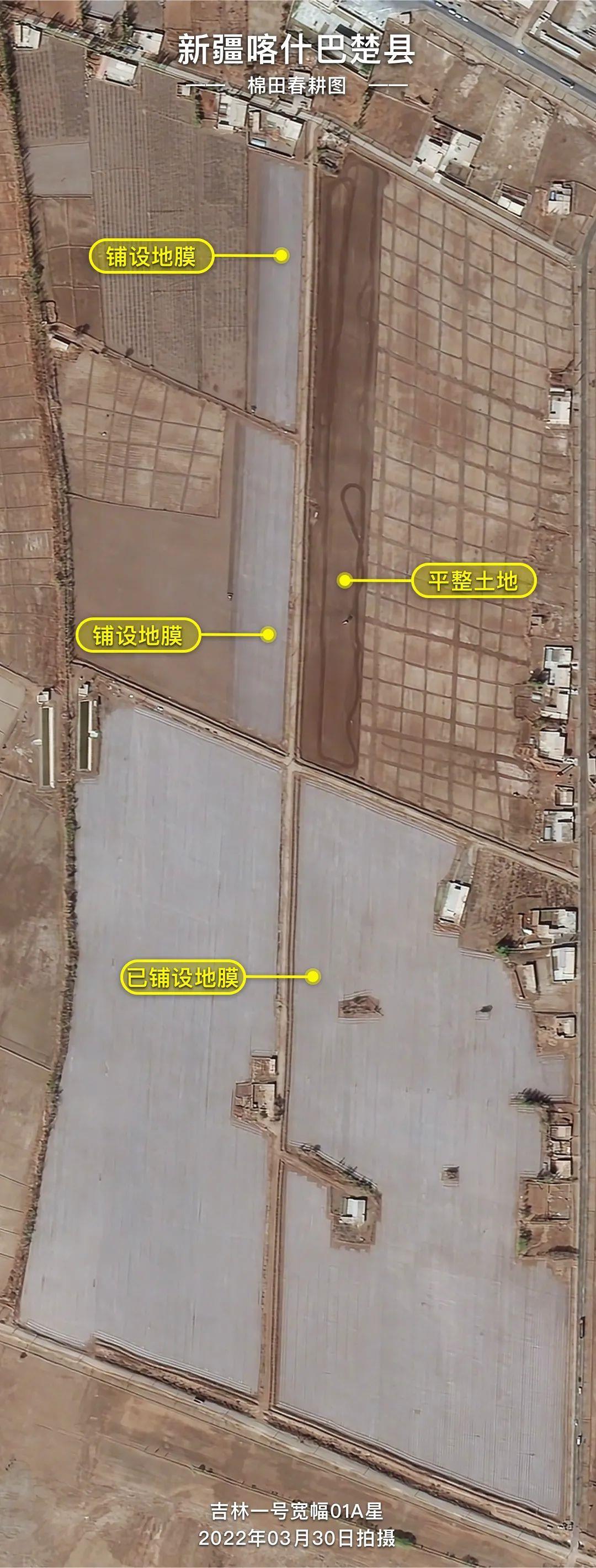
High-resolution satellite images show springtime cotton planting in China’s Xinjiang
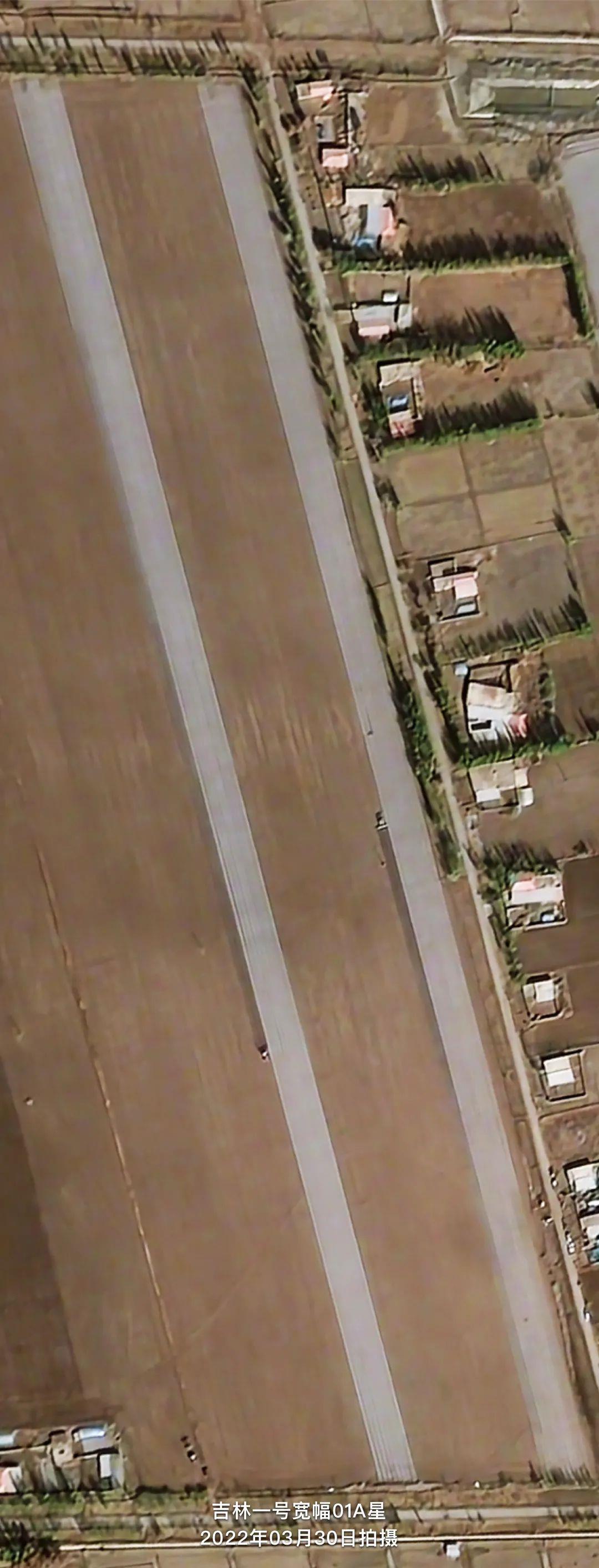
Images taken by a satellite in China’s commercial remote sensing satellite system Jilin-1 show how technology is making things much easier in northwest China’s Xinjiang Uygur Autonomous Region during this year’s cotton spring sowing and planting season.
(Photo/WeChat account of Jilin-1 satellites)
The images show autopiloted tractors empowered by China’s own domestically-developed BeiDou Satellite Navigation System (BDS), which are now busy preparing fields for the spring sowing and planting season across a 20,000-mu (1,333.3 hectares) area in Bachu county, Kashgar prefecture of Xinjiang.
When supported by the BDS, these large tractors are capable of completing a combination of tasks, including raking, fertilizing, laying plastic mulch, sowing, and laying drip irrigation belts, all in one go. Besides, the seedlings that they sow are planted row by row in straight lines. The high efficiency of these autonomous unmanned vehicles saves on labor and other costs.

(Photo/WeChat account of Jilin-1 satellites)
Bachu county has so far developed 400,000 mu of high-standard farmland, accounting for nearly a quarter of the county’s total arable land.
According to the latest survey conducted by the China Cotton Association, nearly 43.2 million mu of fields in China are expected to be used for growing cotton in 2022, with the cotton area in Xinjiang expanding by 2 percent year-on-year for this farming season.

(Photo/WeChat account of Jilin-1 satellites)
(Photo/WeChat account of Jilin-1 satellites)

(Photo/WeChat account of Jilin-1 satellites)
Photos


Related Stories
- Cotton seeds sowing starts in Xinjiang
- BeiDou-powered machinery performs with high efficiency in Xinjiang cotton sowing season, debunks forced labor accusations
- Spring farming starts in Xinjiang
- Production of domestically-made cotton pickers reaches peak in Xinjiang
- Xinjiang in full bloom
- Keyakekuduke Watchtower Site in China's Xinjiang listed in top 10 archaeological discoveries of 2021
- UAE officials praise Xinjiang's development
- Winter sports fever boosts ice-snow tourism
- Xinjiang welcomes spring with apricot blossoms in full bloom
- Xinjiang, My home: A family workshop promoting ethnic embroidery to outside world
Copyright © 2022 People's Daily Online. All Rights Reserved.
