
 |
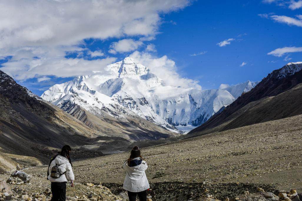
| Photo taken on Aug. 26 shows visitors at the foot of Mount Qomolangma. (Photo by Peng Huan/People’s Daily Online) |
China and Nepal jointly announced that the new height of Mount Qomolangma that straddles their border is 8,848.86 meters on Dec. 8. The figure, including the snow height based on the International Height Reference System (IHRS), has become a hot topic since the announcement.
Affected by factors such as the movements of the earth’s tectonic plates and earthquakes, the environment of the Qomolangma region is constantly changing.
China has conducted scientific research on the region and released the height of the peak in different periods. In 1975, the country measured Mount Qomolangma as standing 8,848.13 meters above sea level. In 2005, China re-measured the peak’s rock height at 8,844.43 meters. This year, a team of Chinese surveyors successfully arrived at the summit again and conducted a series of surveys.
This year’s survey achieved multiple “firsts,” said Li Guopeng, captain of the First Geodetic Surveying Brigade under the Ministry of Natural Resources (MNR).
“We designed and surveyed several leveling routes at the foot of the Qomolangma from the national first-class benchmark in Xigaze in southwest China’s Tibet Autonomous Region. It is the first time that the benchmark of the mountain’s evaluation was extended to the border between China and Nepal, and we achieved the world’s first measured gravity value of the mountain’s peak,” Li said.
“Also in a world’s first, China used airborne gravity surveys to measure the gravity value of areas where humans cannot reach,” he noted.
Using various technical tools, researchers collected 144 million pieces of the latest topographic data of more than 1 million square kilometers of the peak and its surrounding areas.
Dang Yamin, a researcher at the Chinese Academy of Surveying & Mapping at the MNR, said that acquiring the field data for this year’s measurement was a hard-won victory, with abundant high-quality data acquired. Experts also carried out considerable analyses to examine the quality of the data and to ensure the accuracy of the calculation.
Different from the previous two rounds of height measurement on the height of Mount Qomolangma conducted by China, surveyors from China and Nepal finally reached a conclusion on the snow height of the mountain based on the IHRS after joint data processing.
Dang pointed out that China and Nepal applied different vertical datums, explaining why the IHRS was adopted in this year’s measurement.
China adopted its national vertical datum, which was defined by the mean sea level of the Yellow Sea while Nepal a datum based on the mean seal level of the Bay of Bengal, he added.
Considering that the release of the elevation data by the two countries would better reflect their friendship and cooperation, a joint technical committee on the measurement of the height of Mount Qomolangma decided to adopt the IHRS after careful discussion, so as to implement the consensus of the two heads of states to jointly declare the re-measured height of the summit.
“The global vertical datum based on the mean sea level in the world, released by relevant international organizations, is authoritative,” Dang said.
He added that it’s the first time in the world that a global vertical datum in the Qomolangma region was established, a breakthrough in the history of Mount Qomolangma’s measurement.
Results from this scientific survey of the Qomolangma region provided important data and technical support for the region’s ecological protection, geological survey, and crustal movement monitoring, demonstrating China’s comprehensive strength and progress in surveying and mapping technology, said Guo Chunxi, head of the MNR’s Geodetic Data Processing Center.
The accurate measurement of Mount Qomolangma’s height is of great significance. Experts said that from a scientific point of view, the peak’s height and its changes provide data support for the movements of the Indian and Eurasian plates as well as changes in the Qomolangma region’s ecology, and are of great value in explaining tectonic movements in the world and developing geoscience theories.
Moreover, after an 8.1-magnitude earthquake struck Nepal in April 2015, there had been controversy around the world over its influences on the height of the peak, which can only be confirmed through accurate measurement.
Technically, measuring the height of the world’s highest peak, with a changeable climate and complex environment featuring extremely low temperature and hypoxia, poses a severe test to the human body and places high requirements on measurement equipment and surveying technology. In this sense, the accurate measurement of the peak’s height also reflects a country’s comprehensive surveying and mapping technology and capabilities.
From a political and diplomatic perspective, Mount Qomolangma is the boundary peak between China and Nepal and an important symbol of the China-Nepal friendship. This year marks the 65th anniversary of the establishment of diplomatic relations between the two countries. It also marks the 60th anniversary of human beings reaching the summit of the peak via the north ridge, and the 45th anniversary of China accurately measuring and announcing the height of the peak for the first time.
China and Nepal’s joint announcement of the new height of the peak will surely further promote their good-neighborly and friendly ties and push forward greater progress of bilateral friendship across the Himalayas. It is also of important commemorative significance.
 |

 Award-winning photos show poverty reduction achievements in NE China's Jilin province
 People dance to greet advent of New Year in Ameiqituo Town, Guizhou
 Fire brigade in Shanghai holds group wedding
 Tourists enjoy ice sculptures in Datan Town, north China
 Sunset scenery of Dayan Pagoda in Xi'an
 Tourists have fun at scenic spot in Nanlong Town, NW China
 Harbin attracts tourists by making best use of ice in winter
 In pics: FIS Alpine Ski Women's World Cup Slalom
 Black-necked cranes rest at reservoir in Lhunzhub County, Lhasa
 China's FAST telescope will be available to foreign scientists in April