First geosynchronous orbit SAR satellite enters working orbit

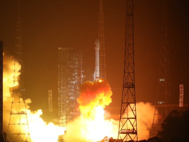
China sent the L-SAR4 01satellite into space from the Xichang Satellite Launch Center in southwest China's Sichuan Province on Aug. 13. (Photo provided by the China National Space Administration)
BEIJING, Aug. 21 (Xinhua) -- China's recently-launched L-SAR4 01 satellite, the world's first geosynchronous (high Earth orbit) synthetic aperture radar (SAR) satellite stepping into the project implementation stage, has entered its working orbit with its SAR antenna successfully deployed, according to the China National Space Administration (CNSA).
The L-SAR4 01 satellite, sent into space on Aug. 13, has entered its designated orbit after four orbital adjustments and completed its initial flight control testing, the CNSA said, adding that the satellite is working properly and will continue to carry out in-orbit testing.
SAR uses radio waves to produce high-resolution images rather than utilizing the light from the sun as with optical images. It can capture images at night and see right through clouds and smoke. It is a 24-hour, all-weather technology.
Currently, all in-orbit SAR satellites worldwide operate in low Earth orbits (LEO) with altitudes typically lower than 1,000 km. Geosynchronous SAR works in orbit with an altitude of approximately 36,000 km, with a revisit period of one day, much shorter than that of LEO SAR.
Researchers from the China Academy of Space Technology spent 15 years developing the L-SAR4 01 satellite. They proposed the plan of a large-diameter circular reflector antenna with a phased array feed scheme, realizing technological progress in related fundamental theories, system design and precision manufacturing.
According to the CNSA, the L-SAR4 01 satellite can provide service for seven industries, including disaster prevention and mitigation, resource prospecting and exploration, water conservancy, meteorology, agriculture, environmental protection, and forestry.
The satellite is currently the most widely used remote-sensing satellite in China. It is expected to improve the country's space-based disaster monitoring system, enrich observation methods in key regions of China, and enhance disaster prevention, reduction and relief.
The satellite is a remote sensing research satellite listed in China's national medium and long-term development plan for civil space infrastructure (2015-2025).
According to Meng Lingjie, deputy chief engineer of the CNSA Earth Observation and Data Center, in 2022, China launched more than 200 satellites. The country's national civil space infrastructure system, mainly composed of satellite remote sensing, communication and navigation, has taken the initial shape, Meng noted.
China will continue to improve the construction of national space infrastructure and the space information service, such as ubiquitous connectivity and precise spatiotemporal data.
Photos
 Groom in C China's Luoyang picks up bride with electric moped fleet
 Small railway station in N China's Inner Mongolia attracts throngs of tourists
 'Space suit'-clad tourists immerse themselves at extra-terrestrial-like landscape in China's Inner Mongolia
 In pics: Autumn harvest in SW China's Sichuan
Related Stories
Copyright © 2023 People's Daily Online. All Rights Reserved.


