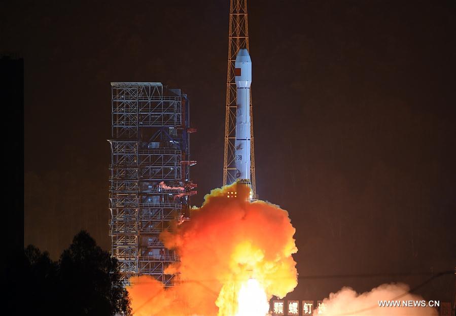
Photo taken on Dec. 29, 2015 shows the Long March-3B carrier rocket is launched with the Gaofen-4 Satellite in Xichang of southwest China's Sichuan Province. (Xinhua/Xue Yubin)
Thanks to years of efforts incorporating the deployment of a network of satellites, China has enhanced its capability of disaster prevention and mitigation and contributed to the world through international cooperation.
Since the successful launch of its first Earth observation satellite, the Gaofen-1, in 2013, the country has almost completed the construction of its space-based Earth observation system with several high-definition satellites. By the end of 2019, China will launch another such satellite, indicating the complete construction of the system.
The country shares system data with countries all over the world to help towards international disaster prevention and mitigation. In July, at the request of the International Charter on Space and Major Disasters, China scheduled three earth observation satellites, namely Gaofen-1, Gaofen-2 and Gaofen-3, to capture images of flood-stricken regions in India and provide satellite data to assist India with its flood relief efforts. The system also helped Sri Lanka’s flood relief operations in 2015 and Ecuador’s earthquake relief efforts in 2016.
China has also dedicated years to building its system of Fengyun meteorological satellites. Before 2025, the country will launch three high-orbit and six low-orbit Fengyun satellites.
Amid the recent typhoon Lekima, China shared relevant data with the international community, providing convenience for other countries and regions in the Western Pacific to monitor and deal with the typhoon.
In March, China provided a remote-sensing monitor report on flooding in Iran via Fengyun, which greatly assisted the country’s evacuation efforts.
In April, the China Meteorological Administration’s National Satellite Meteorological Center forecasted the tropical cyclone Kenneth and provided meteorological support for Mozambique’s disaster relief efforts via Fengyun satellites.
In addition, the China Meteorological Administration has set up an Emergency Support Mechanism for international users of Fengyun satellites.
So far, over 20 countries have registered as users of the mechanism, and about 100 countries and regions have used data offered by Fengyun satellites.
To serve Belt and Road countries, the country has also fine-tuned the position of the Fengyun-2 satellite, enabling the Fengyun series satellites to acquire meteorological data of Belt and Road countries with broader coverage.
As China’s Beidou Navigation Satellite System started providing global services last year, the country will contribute more to global disaster prevention and mitigation.
 Fire brigade in Shanghai holds group wedding
 Tourists enjoy ice sculptures in Datan Town, north China
 Sunset scenery of Dayan Pagoda in Xi'an
 Tourists have fun at scenic spot in Nanlong Town, NW China
 Harbin attracts tourists by making best use of ice in winter
 In pics: FIS Alpine Ski Women's World Cup Slalom
 Black-necked cranes rest at reservoir in Lhunzhub County, Lhasa
 China's FAST telescope will be available to foreign scientists in April
 "She power" plays indispensable role in poverty alleviation
 Top 10 world news events of People's Daily in 2020
 Top 10 China news events of People's Daily in 2020
 Top 10 media buzzwords of 2020
 Year-ender:10 major tourism stories of 2020
 No interference in Venezuelan issues
 Biz prepares for trade spat
 Broadcasting Continent
 Australia wins Chinese CEOs as US loses