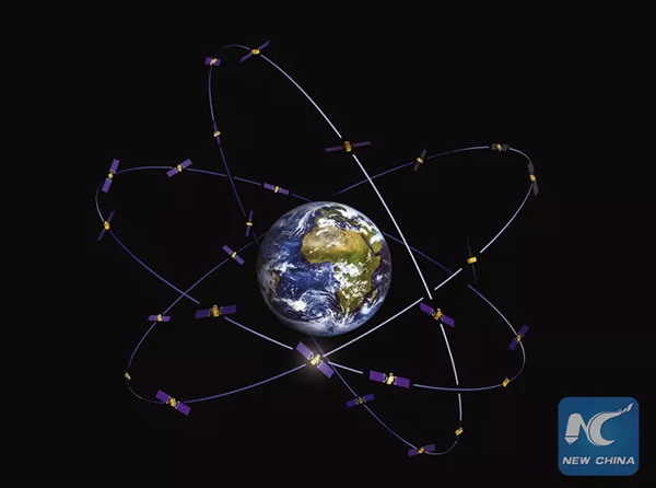


An expert says that the satellite networking system in the Asia-Pacific region based on China’s self-developed Beidou Navigation Satellite System performs better than GPS in terms of positioning, real-time navigation, and accurate timing, according to the WeChat account of People’s Daily on Sept. 26.
Construction of the Beidou-3 global positioning system has already started and four networking satellites will be launched later this year to greatly increase the positioning accuracy of the existing system.
Ran Chengqi, deputy chief designer of the system said Beidou, also known as Compass, will provide all-weather and all-time services, including highly accurate and reliable positioning, navigation, and timing services, as well as short-message service.
The system has become a major supplier of global satellite navigation services. Other systems include the Global Positioning System (GPS) of the US, the Global Navigation Satellite System (GNSS) built by Russia, and the Galileo system of the European Union.
The world’s first man-made earth satellite was launched by the Soviet Union on Oct. 4, 1957, and GPS developed by the U.S. was put into operation in 1995, which now has 30 satellites in medium Earth orbit for military and civilian use. The civilian use is now open to the world.
Like other countries, China used to rely on GPS for research and development of technology, said Ran.
Until the early 1980s, Chinese expert Chen Fangyun put forward the positioning scheme based on two satellites that were launched into high Earth orbit. Although it could not rival the GPS systems in terms of positioning accuracy, it, at least, met the design target.
The expert disclosed that the Beidou-2 system plans to form a global network of 35 Beidou navigation satellites by 2020, five more than GPS. The five geostationary satellites in high Earth orbit are mainly for short-message service.

A GPS receiver
Ran added that, although the launching of the 35 satellites has not been completed, a satellite network for the Asia-Pacific region has already been established.
Of course, Canada and Mexico prefer GPS, but the Beidou system will be more advantageous for countries in the Asia-Pacific region, according to the expert.
Experts from Asia-Pacific countries, including Thailand, Malaysia, Indonesia, Brunei, Cambodia, and Laos were sent to China in July 2014 to study the Beidou-2 system and discuss cooperation. The Chinese government is actively promoting application of the system in the region.
Despite some fuss over its limited capacity in positioning accuracy, the Beidou-1 system is said to have played an important role in the rescue efforts following the devastating Wenchuan earthquake in May 2008, as it provided the only channel connecting the quake-hit area with the outside area, Ran stated.
After the Beidou-2 networking system is established in the region, fishermen can install the terminal system on their ships and will be able to seek help in a timely fashion in case of an emergency.
The Chinese government has even offered a 100-million-yuan ($15.07 million) subsidy for 10,000 fishermen in Liaoning, Shandong, Zhejiang, and Hainan to encourage use of the system.

The expert also disclosed that the charge for sending a short message via the Beidou system is only three tenths of a yuan, the cheapest ever in the history.
In addition, Ran noted that China is planning to install Beidou equipment on light poles and signal towers to form an advanced ground-based system, which, when combined with the space-based satellites, can achieve more accurate real-time positioning than GPS.
Many high-tech enterprises in China have also started to focus on positioning and navigation research, as they can enjoy tax exemption and financial support offered by the Chinese government.
Ran predicts that the Beidou system industry is set to embrace a bright future.
 Fire brigade in Shanghai holds group wedding
 Tourists enjoy ice sculptures in Datan Town, north China
 Sunset scenery of Dayan Pagoda in Xi'an
 Tourists have fun at scenic spot in Nanlong Town, NW China
 Harbin attracts tourists by making best use of ice in winter
 In pics: FIS Alpine Ski Women's World Cup Slalom
 Black-necked cranes rest at reservoir in Lhunzhub County, Lhasa
 China's FAST telescope will be available to foreign scientists in April
 "She power" plays indispensable role in poverty alleviation
 Top 10 world news events of People's Daily in 2020
 Top 10 China news events of People's Daily in 2020
 Top 10 media buzzwords of 2020
 Year-ender:10 major tourism stories of 2020
 No interference in Venezuelan issues
 Biz prepares for trade spat
 Broadcasting Continent
 Australia wins Chinese CEOs as US loses