


Engineers maintain satellite data receiving system in NE China
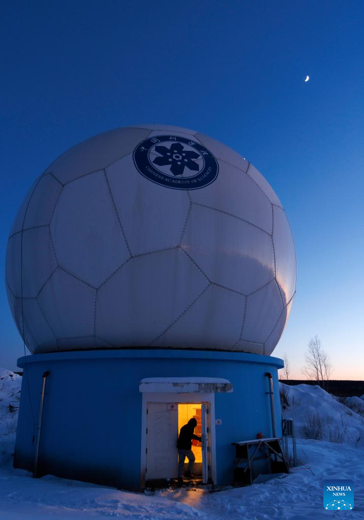
Assistant Engineer Tian Dong enters the antenna radome pedestal as he prepares to maintain the satellite data receiving system at the Mohe Station of the China Remote Sensing Satellite Ground Station in Mohe, northeast China's Heilongjiang Province, on Jan. 24, 2026. (Xinhua/Jin Liwang)
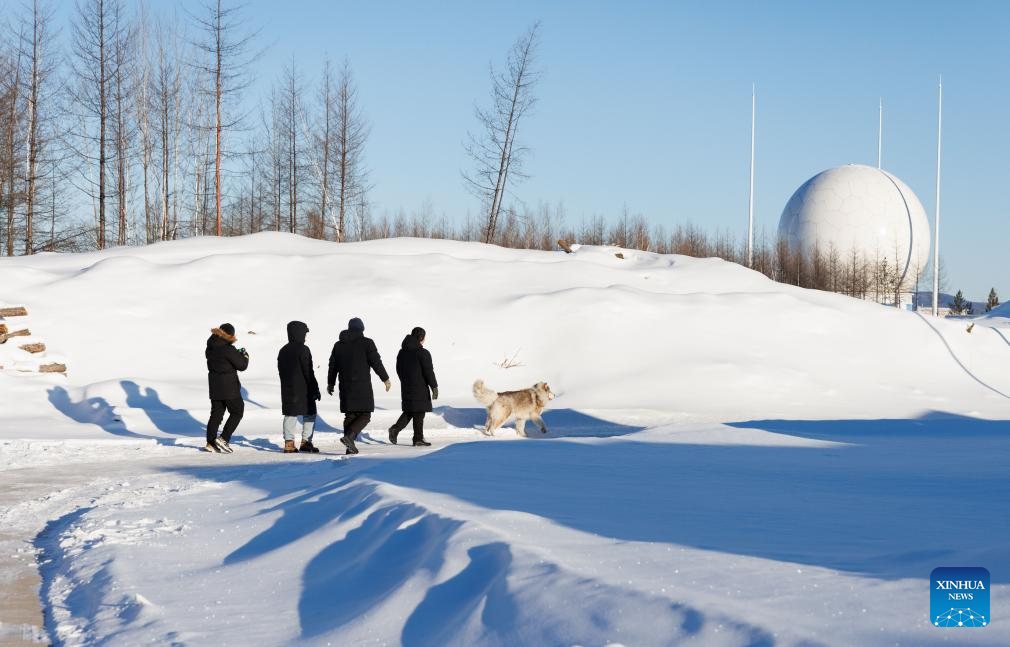
The Mohe Station of the China Remote Sensing Satellite Ground Station is China's northernmost satellite data receiving station. Normally the facility has only one staff member on duty, but as the Spring Festival approaches, four of its staff members have gathered in severe cold weather to conduct thorough winter inspections and maintenance.
Developed by the Aerospace Information Research Institute under the Chinese Academy of Sciences, the Mohe Station commenced operations on Dec. 12, 2025.
Located in Mohe, China's northernmost city in Heilongjiang Province, the station is designed to autonomously receive satellite data. It is now tasked with receiving data from 25 national land observation satellites, the institute said.
The Mohe station boasts a maximum channel downlink data rate of 2 gigabits per second and can transmit the received data in real time. Leveraging its high-latitude geographical advantage, the station can extend the daily receiving time window for polar-orbiting satellites by over 20 percent.
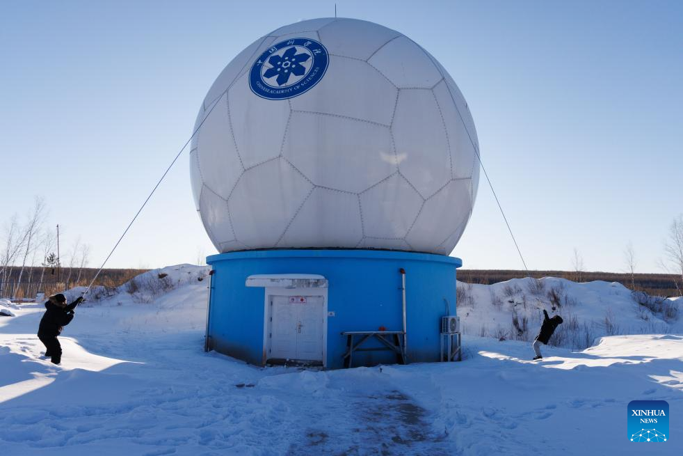
Engineer Li Qiang (L) and Assistant Engineer Tian Dong clear snow on top of the antenna radome at the Mohe Station of the China Remote Sensing Satellite Ground Station in Mohe, northeast China's Heilongjiang Province, on Jan. 25, 2026. (Xinhua/Jin Liwang)
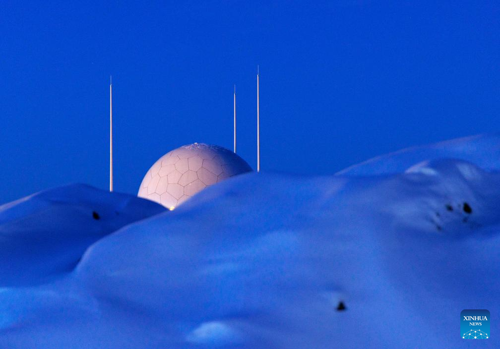
This photo taken on Jan. 24, 2026 shows the antenna radome at the Mohe Station of the China Remote Sensing Satellite Ground Station in Mohe, northeast China's Heilongjiang Province. (Xinhua/Jin Liwang)
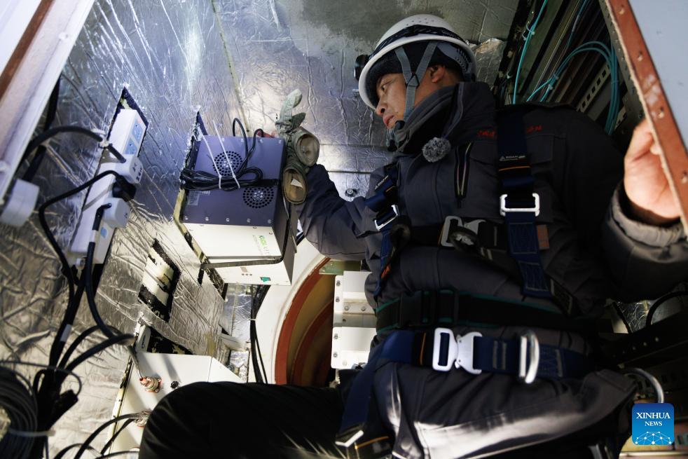
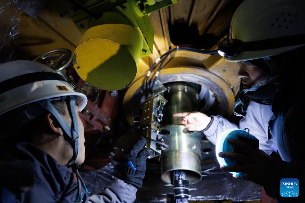
Shi Shengpu, director of the Mohe Station of the China Remote Sensing Satellite Ground Station, performs maintenance tasks inside the central structure of the antenna at the station in Mohe, northeast China's Heilongjiang Province, on Jan. 25, 2026. (Xinhua/Jin Liwang)
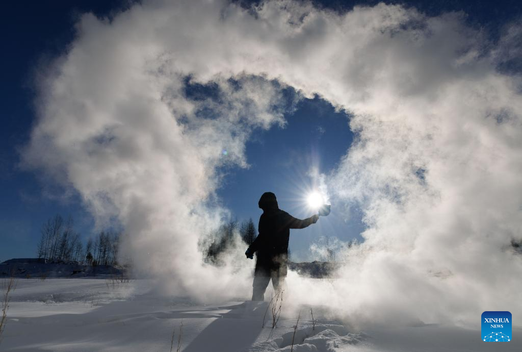
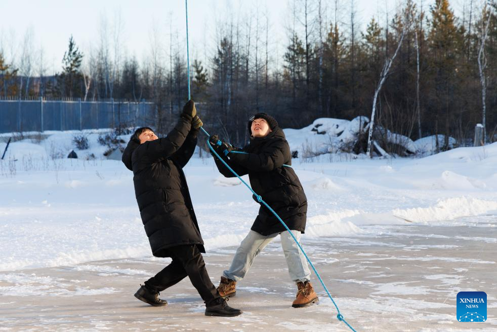
Assistant Engineer Tian Dong plays a game in which splashed water turns into ice in extremely cold air at the Mohe Station of the China Remote Sensing Satellite Ground Station in Mohe, northeast China's Heilongjiang Province, on Jan. 25, 2026. (Xinhua/Jin Liwang)
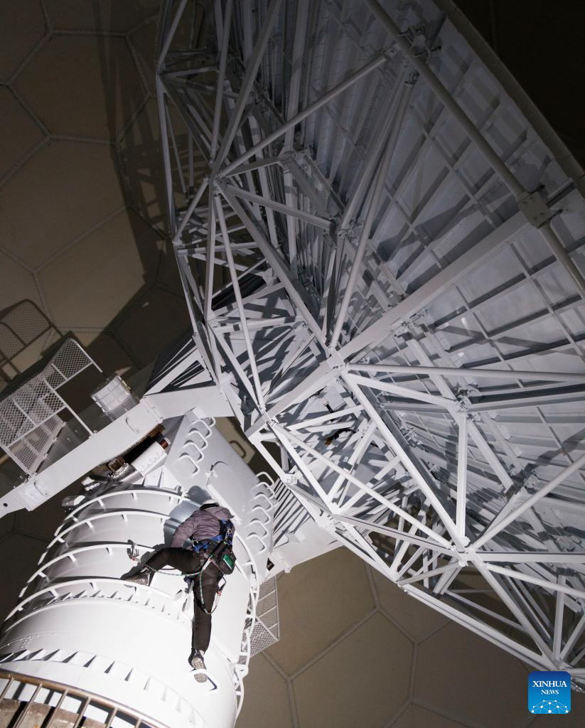
Shi Shengpu, director of the Mohe Station of the China Remote Sensing Satellite Ground Station, climbs up the antenna for maintenance work at the station in Mohe, northeast China's Heilongjiang Province, on Jan. 25, 2026. (Xinhua/Jin Liwang)
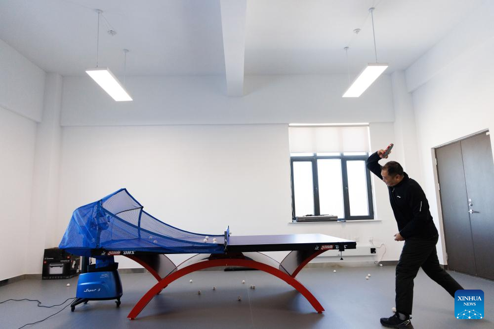
Shi Shengpu, director of the Mohe Station of the China Remote Sensing Satellite Ground Station, practises table tennis in an activity room at the station in Mohe, northeast China's Heilongjiang Province, on Jan. 25, 2026. (Xinhua/Jin Liwang)
Engineer Li Qiang (R) and Assistant Engineer Tian Dong perform maintenance tasks at the azimuth cabin of the satellite data receiving system at the Mohe Station of the China Remote Sensing Satellite Ground Station in Mohe, northeast China's Heilongjiang Province, on Jan. 24, 2026. (Xinhua/Jin Liwang)
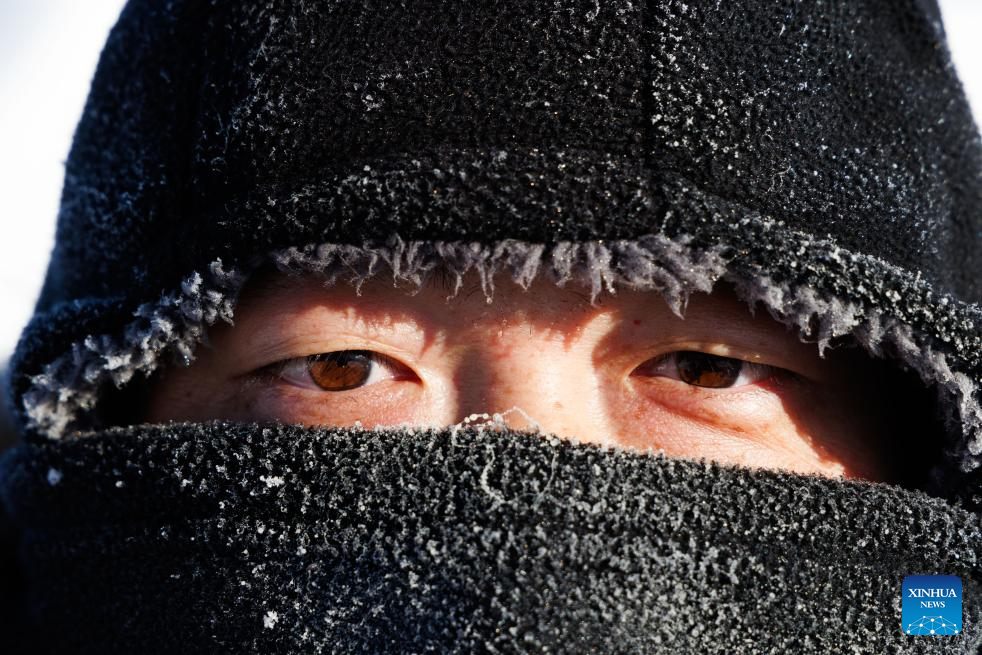
Engineer Li Qiang is pictured with frosts on his hat not long after working outdoors at the Mohe Station of the China Remote Sensing Satellite Ground Station in Mohe, northeast China's Heilongjiang Province, on Jan. 25, 2026. (Xinhua/Jin Liwang)
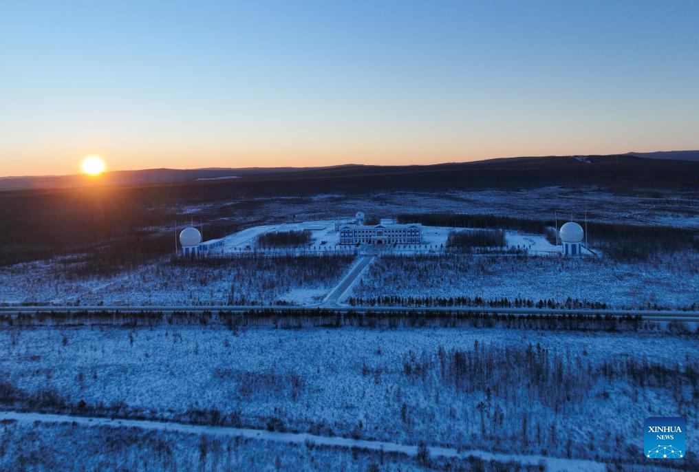
An aerial drone photo taken on Jan. 25, 2026 shows a panoramic view of the Mohe Station of the China Remote Sensing Satellite Ground Station in Mohe, northeast China's Heilongjiang Province. (Xinhua/Jin Liwang)

Staff members monitor the operation of the satellite data receiving system at the Mohe Station of the China Remote Sensing Satellite Ground Station in Mohe, northeast China's Heilongjiang Province, on Jan. 24, 2026. (Xinhua/Jin Liwang)
Engineer Gao Jingfei (L) and Assistant Engineer Tian Dong clear snow on top of the antenna radome at the Mohe Station of the China Remote Sensing Satellite Ground Station in Mohe, northeast China's Heilongjiang Province, on Jan. 25, 2026. (Xinhua/Jin Liwang)
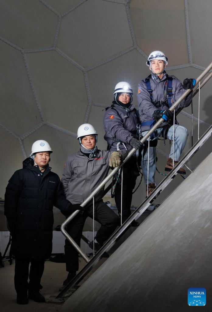
Shi Shengpu, director of the Mohe Station of China Remote Sensing Satellite Ground Station (2nd L), Engineer Gao Jingfei (1st L), Engineer Li Qiang (3rd L) and Assistant Engineer Tian Dong pose for a photo inside the antenna radome at the Mohe Station of the China Remote Sensing Satellite Ground Station in Mohe, northeast China's Heilongjiang Province, on Jan. 24, 2026. (Xinhua/Jin Liwang)
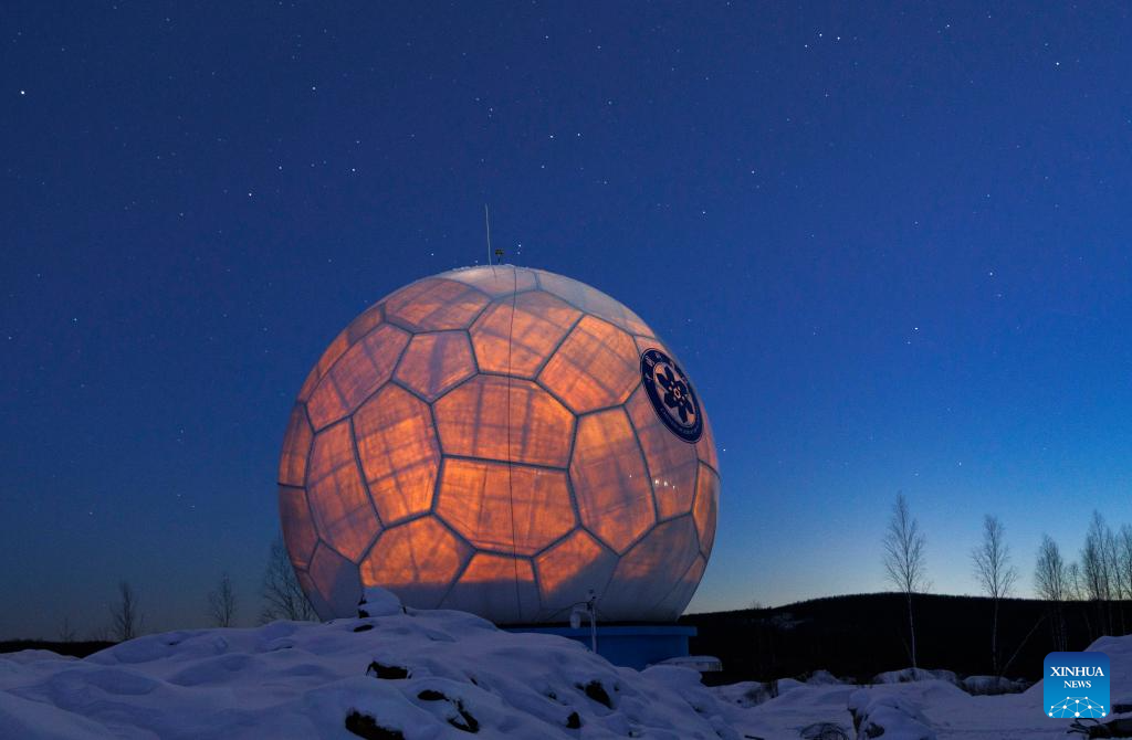
This photo taken on Jan. 24, 2026 shows the antenna radome under the starry sky at the Mohe Station of the China Remote Sensing Satellite Ground Station in Mohe, northeast China's Heilongjiang Province. (Xinhua/Jin Liwang)
Staff members return to the office building after maintaining the satellite data receiving system at the Mohe Station of the China Remote Sensing Satellite Ground Station in Mohe, northeast China's Heilongjiang Province, on Jan. 25, 2026. (Xinhua/Jin Liwang)
Photos


Related Stories
Copyright © 2026 People's Daily Online. All Rights Reserved.
