


Digital technologies facilitate wildlife conservation in NW China's Xinjiang
Through innovative use of modern technologies, such as satellite tracking systems, infrared cameras, drones, video surveillance devices, remote sensing equipment, and ranger patrol apps, northwest China's Xinjiang Uygur Autonomous Region has been effective in its efforts to conserve its wildlife based on comprehensive monitoring and extensive research.
Xinjiang is one of the regions in China with the richest biodiversity, and is home to over 700 species of wild vertebrates, including 178 species listed as key wild animals under national protection.
With a smart wildlife conservation system featuring the innovative application of modern information technology, the region has significantly improved its ability to preserve the diverse beauty of its flora and fauna.
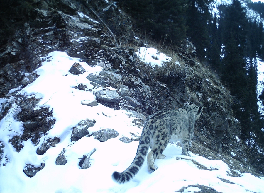
Photo taken on Jan. 19, 2019 shows a snow leopard in Xinjiang. (Xinhua)
Thanks to the their ability to automatically capture images without disturbing wildlife, infrared cameras have become an essential tool for monitoring and researching wild animals, said Ma Ming, a research fellow of Xinjiang Institute of Ecology and Geography under the Chinese Academy of Sciences.
In recent years, the once-elusive snow leopard, a wild animal species under national first-class protection in China, along with other wildlife, has been frequently captured in videos and images, as infrared cameras have been widely used to monitor wild animals, according to Ma.
Ma was the first Chinese scholar to capture images of snow leopards in their natural habitat using infrared cameras. In 2005, he took 32 clear images of snow leopards at the Tomur Peak in the Tianshan Mountains in Xinjiang.
"Back then, infrared cameras had limited storage capacity and were expensive. The devices today are affordable, lightweight, and intelligent, which allows them to be deployed on a large scale," Ma explained.
Today, infrared cameras have become commonly used equipment for monitoring Xinjiang's wildlife, according to Ma, who noted that they are widely used to study animal populations, home ranges, and behavioral patterns, providing an abundance of data for the formulation of conservation strategies.
In addition to technological means on the ground, satellites and drones have also become part of Xinjiang's wildlife conservation system.
The Xinjiang Lop Nur Wild Camel National Nature Reserve, which is inhabited by China's first-class nationally protected wild Bactrian camels, has established a space-air-ground integrated monitoring system comprised of equipment including satellites, drones, and ground monitoring facilities.
By utilizing a satellite positioning system to track 26 wild Bactrian camels fitted with satellite tracking collars and patrolling relevant areas with drones, the nature reserve has gained valuable insights into the animals' activity range and migration patterns while at the same time detecting illegal activities and minimizing disturbance to the wild animals and their habitat in a timely manner.
Currently, the reserve has achieved comprehensive monitoring and tracking of wild Bactrian camels' development, including their growth, reproduction, and migration.
At Xinjiang's Bosten Lake, an important habitat for migratory birds in China, experts from the National Bird Banding Center of China have fitted birds with satellite tracking devices to better understand and study their migration patterns, distribution, seasonal movements, and population structures.
These devices can continuously transmit location information to a backend system, thus clearly displaying the migration routes of migratory birds and providing important data for analyzing their migration paths, stopover sites, and timing.
In the Kalamaili Nature Reserve of Xinjiang, information about the locations of the endangered Przewalski's horse is displayed in real time on large screens at the reserve’s command center.
Unmanned drones stationed deep within the reserve can autonomously take off and track wild animals, monitor for fires, and assist with emergency response after receiving instructions from the command center.
In recent years, Xinjiang has accelerated the construction of its smart wildlife conservation system. The region's forestry and grassland bureau has signed strategic cooperation agreements with the Xinjiang branches of China Telecom and China Mobile, two of the country’s leading telecommunication operators, to promote the application of 5G, artificial intelligence, the Internet of Things, and other technologies in key areas such as land greening, forestry and fruit industry, forest and grassland fire monitoring, and conservation-oriented wildlife monitoring, continuously enhancing its ecological perception capabilities.
As Xinjiang's smart wildlife conservation system continues to evolve, the region's ecological conservation efforts are shifting towards the application of more advanced technologies such as cloud computing and big data analysis, making human-nature interactions more visible and tangible.
Photos


Related Stories
- Xinjiang's Kuqa ramps up efforts to preserve, utilize historical resources
- Chinese premier urges Xinjiang to boost people's wellbeing, high-quality development
- International youth discover the Xinjiang surprise
- Xinjiang tourism revenue up nearly 34 pct during May Day holiday
- From horseback to train, a Tajik conductor's journey
- Legislation protecting Xinjiang ancient city comes into force
- Horgos sees thriving cross-border tourism
Copyright © 2026 People's Daily Online. All Rights Reserved.
