MOUNT QOMOLANGMA BASE CAMP, May 27 (Xinhua) -- A Chinese surveying team reached the summit of Mount Qomolangma on Wednesday morning to conduct a series of surveys on the pinnacle of the planet. Here is a brief review of major Chinese measurements of Mount Qomolangma.
Qomolangma is the peak's Tibetan name, which has existed for centuries among locals and preceded "Mount Everest," a name created to remember a British surveyor general of India and still widely used in the West.
According to Lin Chao, a late prestigious expert on geographic history and topography, the Manchurian and Han Chinese name for Qomolangma first appeared in "Huang Yu Quan Lan Tu," or "Atlas of the Whole Imperial Territory," following a mission sent by the Qing Dynasty (1644-1911) government to survey and map Tibet around 1715.
The map, despite showing an accurate relative position of the mountain and its glaciers, did not publish its height, though historians said surveyors had brought measurement equipment such as a four-vernier, semi-circular protractor.
After the founding of the People's Republic of China in 1949, the central Chinese government called for an accurate measurement of the height of Mount Qomolangma and the drawing of a topographic map.
In 1975, Chinese surveyors measured Mount Qomolangma as standing 8,848.13 meters above sea level. The released height was recognized by the international community.
In this survey, the Chinese team, for the first time in human history, erected a survey marker atop Mount Qomolangma, allowing six survey points at the foot of the mountain to simultaneously measure the height of the peak.
In 2005, China remeasured the elevation of Mount Qomolangma, combining traditional geodetic methods and satellite technologies. The task adjusted the height after measuring the depth of the snow cap atop the summit.
The 2005 survey registered the summit's rock height at 8,844.43 meters and its ice-snow layer at 3.5 meters deep. There was 1 meter of unknown material, probably a mixture of ice and gravel, between the rock head and the snow cap.
The survey boasted many technological breakthroughs: China obtained more accurate data by using an advanced GPS measurement system; radar detectors replaced poles to determine ice and snow thickness; and laser ranging methods were adopted, said Chen Junyong, an academician of the Chinese Academy of Sciences.
 Fire brigade in Shanghai holds group wedding
 Tourists enjoy ice sculptures in Datan Town, north China
 Sunset scenery of Dayan Pagoda in Xi'an
 Tourists have fun at scenic spot in Nanlong Town, NW China
 Harbin attracts tourists by making best use of ice in winter
 In pics: FIS Alpine Ski Women's World Cup Slalom
 Black-necked cranes rest at reservoir in Lhunzhub County, Lhasa
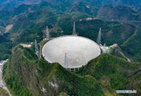 China's FAST telescope will be available to foreign scientists in April
 "She power" plays indispensable role in poverty alleviation
 Top 10 world news events of People's Daily in 2020
 Top 10 China news events of People's Daily in 2020
 Top 10 media buzzwords of 2020
 Year-ender:10 major tourism stories of 2020
 No interference in Venezuelan issues
 Biz prepares for trade spat
 Broadcasting Continent
 Australia wins Chinese CEOs as US loses