(Photo: sast.net)
China has officially launched the development of satellites and rockets of the Tianhe Project, which aims to move water vapor in the sky from the damp west part of the country to the arid north.
Tianhe can be translated as “river in the sky.”
A model of an observation satellite that is part of the first phase of the Tianhe Project will make its debut at the 12th China International Aviation and Aerospace Exhibition (Airshow China 2018), according to Shanghai Academy of Spaceflight Technology (SAST).
Liu Weiliang, the general commander of the satellite team, said that the Tianhe Project satellites and rockets are developed by SAST.
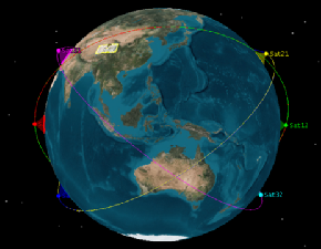
SAST plans to launch the first batch of “Tianhe-1” satellites by 2020 and carry out a demonstration of the viability of the Tianhe Project.
SAST is also planning to complete a six-satellite network by 2022, providing technical support for the construction of an “air corridor” transmitting water vapor to arid north China.
Chinese scientist and academician Wang Guangqian and his team found that there are water vapor channels from the West Indian Ocean, the East Indian Ocean, the Yunnan-Guizhou Plateau, and Central Asia. These cloud water resources have great potential for development.
The Tianhe Project is a special project for the development and utilization of air water resources. Through scientific analysis of the distribution and movement patterns of water in the atmosphere, a new type of manual intervention technology will be adopted to realize the overall regulation and utilization of air water resources and surface water resources in different regions.
According to Zhu Wei, the chief designer of Tianhe satellite, the Tianhe-1 satellite is equipped with payloads such as microwave temperature and humidity meters, precipitation measurement radar and cloud water detectors. The satellite can achieve high-precision detection through a combination of active and passive measures.
Among these payloads, the microwave temperature and humidity meters can accurately detect the vertical distribution of atmospheric temperature and humidity, capturing the distribution of water vapor in the air. The precipitation measurement radar can monitor the three-dimensional distribution of precipitation. The water vapor detector can make an atmospheric cloud map and detect the surface environmental characteristics of the Sanjiangyuan area on the Tibetan Plateau of Qinghai Province, the origin of much of the water vapor that will be moved to more arid areas.
The 12th China International Aviation and Aerospace Exhibition will be held at the Zhuhai International Airshow Center from November 6 to 11.
 Fire brigade in Shanghai holds group wedding
 Tourists enjoy ice sculptures in Datan Town, north China
 Sunset scenery of Dayan Pagoda in Xi'an
 Tourists have fun at scenic spot in Nanlong Town, NW China
 Harbin attracts tourists by making best use of ice in winter
 In pics: FIS Alpine Ski Women's World Cup Slalom
 Black-necked cranes rest at reservoir in Lhunzhub County, Lhasa
 China's FAST telescope will be available to foreign scientists in April
 "She power" plays indispensable role in poverty alleviation
 Top 10 world news events of People's Daily in 2020
 Top 10 China news events of People's Daily in 2020
 Top 10 media buzzwords of 2020
 Year-ender:10 major tourism stories of 2020
 No interference in Venezuelan issues
 Biz prepares for trade spat
 Broadcasting Continent
 Australia wins Chinese CEOs as US loses