GUANGZHOU, April 15 -- Chinese scientists have created a three-dimensional, digital topographic map of the Antarctic seabed using data collected during a recent expedition.
The map was presented at a press briefing held Friday in the city of Guangzhou during an event to mark the completion of a four-month expedition by the research vessel "Hai Yang Liu Hao" (Ocean Six).
The map was made on the expedition in Antarctica using multi-beam sonar. The vessel emitted multiple pulses of sound that scanned an area measuring 250 kilometers long, 80 kilometers wide, with a maximum depth of 3,500 meters, said He Gaowen, a senior scientist with Guangzhou Marine Geological Survey Bureau.
With 80 gigabytes of data, the researchers were able to compile a high-definition map that can be used in Antarctic research or for navigation.
Compared to a traditional single-beam sonar, multi-beam sonar can quickly collect information about topographic and geological components, and water composition. This information can be used to support research into the evolution of the Antarctic seabed, said Liu Shengxuan, another senior scientist involved in the expedition.
China has used this same technique to map the country's coastal areas, the South China Sea, the Pacific, and the Indian Ocean. The maps have proved invaluable tools across geological surveys and marine mineral exploitation, said Ding Weifeng, an Earth exploration scientist at a research institute under State Oceanic Administration.
The mapping of the Antarctic seabed will also provide a large amount of information for polar scientific research, Ding said.
 Fire brigade in Shanghai holds group wedding
 Tourists enjoy ice sculptures in Datan Town, north China
 Sunset scenery of Dayan Pagoda in Xi'an
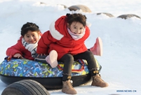 Tourists have fun at scenic spot in Nanlong Town, NW China
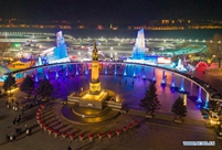 Harbin attracts tourists by making best use of ice in winter
 In pics: FIS Alpine Ski Women's World Cup Slalom
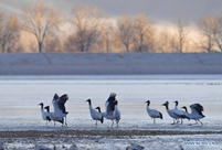 Black-necked cranes rest at reservoir in Lhunzhub County, Lhasa
 China's FAST telescope will be available to foreign scientists in April
 "She power" plays indispensable role in poverty alleviation
 Top 10 world news events of People's Daily in 2020
 Top 10 China news events of People's Daily in 2020
 Top 10 media buzzwords of 2020
 Year-ender:10 major tourism stories of 2020
 No interference in Venezuelan issues
 Biz prepares for trade spat
 Broadcasting Continent
 Australia wins Chinese CEOs as US loses