
Chinese scientists are drawing a 1:2.5 million scale geological map of the Moon.
Ouyang Ziyuan, first chief scientist of China's lunar exploration program, said five universities and research institutes have set standards for digital mapping and drawing of the Moon's geological structure.
A sketch version of the map, 4.36 meters by 2.2 meters, will be finished by 2018, and released by 2020.
The map will provide information on geology, structure and rock types and will reflect the timeline of the Moon's evolution.
Chen Shengbo, a geologist with Jilin University in northeast China's Jilin Province, and his team are responsible for drawing the lunar structure outline, just one part of the work. He said the map would clearly show lunar geography such as geographic fractures and the size, appearance, and the structure of craters.
Chen said mapping depends on data and images sent by circumlunar satellites from home and abroad. Lunar map making is not like drawing a map of the Earth, where scientists can go to the scene in person if they are not sure of their information.
China's satellites have captured global images of the Moon, which contribute to the precision of lunar maps.
 Fire brigade in Shanghai holds group wedding
 Tourists enjoy ice sculptures in Datan Town, north China
 Sunset scenery of Dayan Pagoda in Xi'an
 Tourists have fun at scenic spot in Nanlong Town, NW China
 Harbin attracts tourists by making best use of ice in winter
 In pics: FIS Alpine Ski Women's World Cup Slalom
 Black-necked cranes rest at reservoir in Lhunzhub County, Lhasa
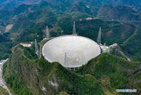
 China's FAST telescope will be available to foreign scientists in April
 "She power" plays indispensable role in poverty alleviation
 Top 10 world news events of People's Daily in 2020
 Top 10 China news events of People's Daily in 2020
 Top 10 media buzzwords of 2020
 Year-ender:10 major tourism stories of 2020
 No interference in Venezuelan issues
 Biz prepares for trade spat
 Broadcasting Continent
 Australia wins Chinese CEOs as US loses