Fri,Jul 4,2014
 Global ambassadors of ecotourism gather in Nanjing
 Taiwan woman marries into Kazak family, 100 sheep plus a flat as dowry
 College girls take graduation photos under water in Chongqing
 Cartoon: Xi and football
 Chinese influence sweeps ROK
 Post-90s beauty boxer grapples four men
 3,000-year-old tea town through lenses
 22 archaeological sites along Silk Road in China
 Football babies, Samba dancers embrace 'World Cup'
 Beautiful scenery along China’s Grand Canal
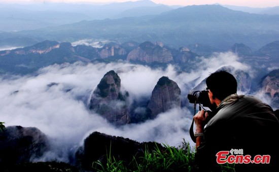
5. Langshan Mountain (Hunan)
Langshan Mountain is one of China's National Geological Parks famous for its unique Danxia landform and literally means "Crimson Glow." It is a rare topographic feature in world geography. Huge rocks of dark red color with grotesque shapes give tourists a marvelous sight. It is located in Xinning County, about 500 km away from Changsha, capital of Hunan province. In the south, Langshan Mountain is connected with Guilin, and in the north it echoes Zhangjiajie. Covering an area of 108 square kilometers, Langshan Mountain is filled with a rich natural scenery and abundant tourism resources. There are more than 500 scenic spots in Langshan Mountain. Among which the most famous are Tianyi Lane, Chili Peak, Zixia Cave, Fuyi River, Innate Bridge, Octagonal Castle, Emperor Xun Forest Park and the Xicun Ancient Dwelling.
In 2008, Langshan Mountain was nominated as a World Nature Heritage. In august, 2009, some experts from the World Nature Heritage visited the site for inspection, and the mountain is expected to become a World Nature Heritage site next July. If this happens, it will be the second World Nature Heritage in Hunan after Wulingyuan in Zhangjiajie. The name of Langshan comes from an ancient legend. It is said that when Shun, a legendary monarch in ancient China, passed by the mountain, he felt the mountains and rivers here were so wonderful, so he entitled the mountain with a Chinese character - Lang, meaning "good mountains."
Langshan Danxia landform and the evolution of its climate and features are representatives of Earth's historical evolution in Southeast Asia since the Cretaceous, and also represents the crust evolution process and the ancient environmental change of southeast China over 100 million years. It is considered to be an excellent example of the main stage of geo-evolution history.
Best travel time: all year around
 |  |
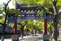 Featured hutongs in Beijing
 Separate college entrance exam
 Flash mob dance
 Picturesque scenery of Ghost City
 Children attend First Writing Ceremony
 Female master poses for graduation photos with son
 Silk Road, China's Grand Canal listed as World Heritage Sites
 PKU students imitate famous paintings in real-person photos
 Chinese 'Slumdog Millionaire'
 Islands in S. China Sea better shown on new vertical atlas of China
 Girl takes father’s portrait to travel the world
 Images of Xi'an: Part one
 In Pictures: Female fans of World Cup
 Top 20 hottest women in the world in 2014
  China's top 10 representative architectures
Day|Week|Month