


First flood peak of 2026 recorded in S China's Liuzhou
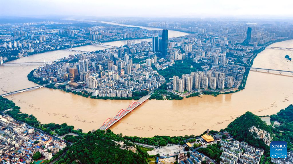
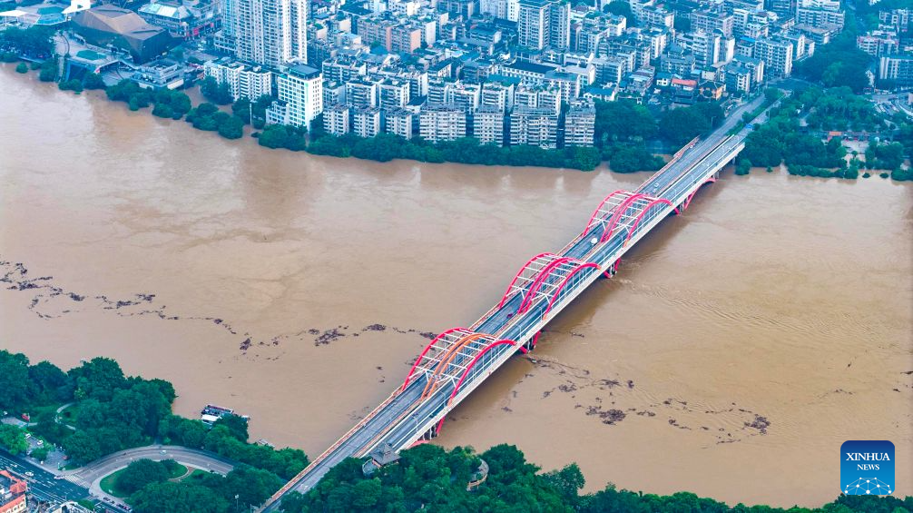
An aerial drone photo taken on June 22, 2026 shows the flood peak passing through the Liujiang River in Liuzhou, south China's Guangxi Zhuang Autonomous Region. Due to heavy rainfall, the Liuzhou hydrological station on the Liujiang River recorded the first flood peak of 2026 on Monday, with the highest water level reaching 85.64 meters, exceeding the alert line by 3.14 meters while flooding some riverfront roads. (Photo by Li Hanchi/Xinhua)
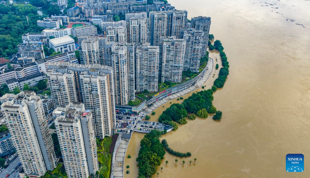
An aerial drone photo taken on June 22, 2026 shows the flood peak passing through the Liujiang River in Liuzhou, south China's Guangxi Zhuang Autonomous Region. Due to heavy rainfall, the Liuzhou hydrological station on the Liujiang River recorded the first flood peak of 2026 on Monday, with the highest water level reaching 85.64 meters, exceeding the alert line by 3.14 meters while flooding some riverfront roads. (Photo by Li Hanchi/Xinhua)
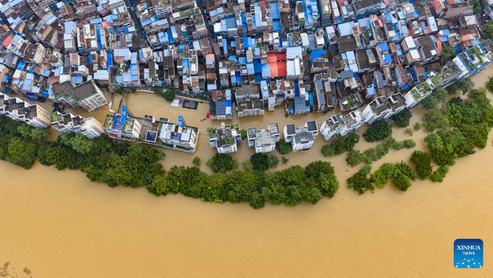
An aerial drone photo taken on June 22, 2026 shows the flood peak passing through the Liujiang River in Liuzhou, south China's Guangxi Zhuang Autonomous Region. Due to heavy rainfall, the Liuzhou hydrological station on the Liujiang River recorded the first flood peak of 2026 on Monday, with the highest water level reaching 85.64 meters, exceeding the alert line by 3.14 meters while flooding some riverfront roads. (Photo by Li Hanchi/Xinhua)
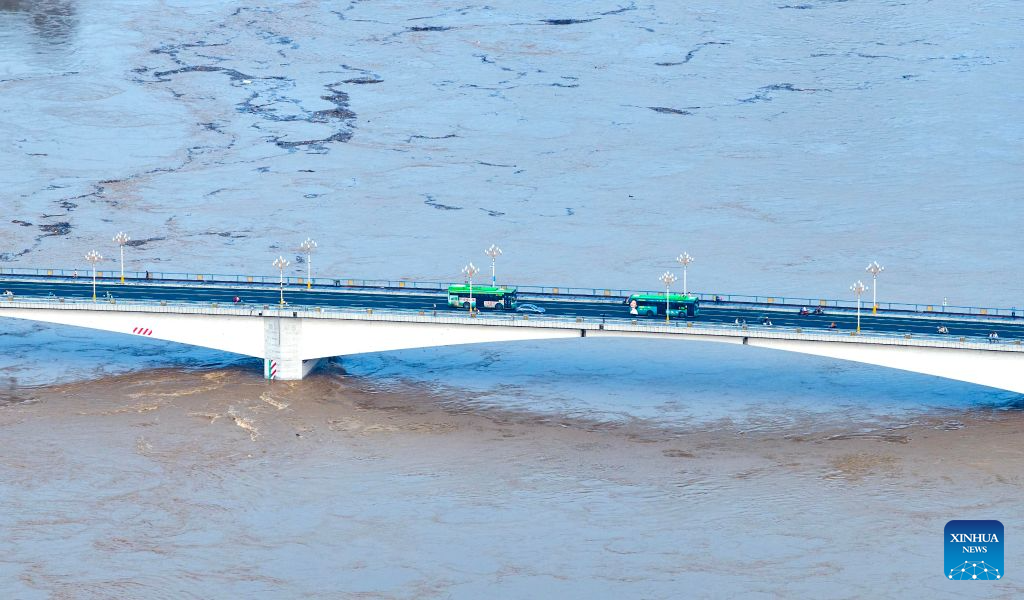
An aerial drone photo taken on June 22, 2026 shows the flood peak passing through the Liujiang River in Liuzhou, south China's Guangxi Zhuang Autonomous Region. Due to heavy rainfall, the Liuzhou hydrological station on the Liujiang River recorded the first flood peak of 2026 on Monday, with the highest water level reaching 85.64 meters, exceeding the alert line by 3.14 meters while flooding some riverfront roads. (Photo by Li Hanchi/Xinhua)
An aerial drone photo taken on June 22, 2026 shows the flood peak passing through the Liujiang River in Liuzhou, south China's Guangxi Zhuang Autonomous Region. Due to heavy rainfall, the Liuzhou hydrological station on the Liujiang River recorded the first flood peak of 2026 on Monday, with the highest water level reaching 85.64 meters, exceeding the alert line by 3.14 meters while flooding some riverfront roads. (Photo by Li Hanchi/Xinhua)
Photos


Related Stories
- Scenery at Longji terraced fields in Guilin City, China's Guangxi
- Luwu Town in China's Guangxi eyes new development as Pinglu Canal nears completion
- Explore Suanye, a sour snack in S China's Guangxi
- Guangxi's Pinglu Canal enters final preparations for September navigation launch
- New canal nears completion, promising shorter route to sea for southwest China
Copyright © 2026 People's Daily Online. All Rights Reserved.
