China launches Venezuela's remote sensing satellite, VRSS-1, in 2012. [File photo: CASC WeChat account]
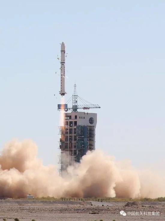
China launched Venezuela's remote sensing satellite, VRSS-2, into a preset orbit from the Jiuquan Satellite Launch Center in northwest China's Gobi desert at 12:13 on Monday.
The VRSS-2 was the third satellite to be jointly launched by China and Venezuela. It will be primarily used by Venezuela for land resource inspection, environmental protection, disaster monitoring and management, crop yield estimation and city planning.
The VRSS-2, with a designed mission life of five years, is an optical remote sensing satellite, equipped with a panchromatic/multispectral, high resolution camera and a short/long wave infrared camera, according to the satellite's developers at the China Academy of Space Technology.
The infrared camera, about the same size as an A3 printer, enables the VRSS-2 to capture images day and night at the required temperature of minus 215 degrees centigrade.
The satellite was launched by a Chinese Long March-2D carrier rocket which was designed by the Shanghai Academy of Spaceflight Technology. This was the 252nd flight mission for the Long March rocket family.
In 2008, China launched Venezuela's first satellite -- the Venesat-1, or "Simon Bolivar" -- which carried communications facilities.
In 2012, Venezuela's first remote sensing satellite, the VRSS-1, was also launched into space from China.
 Fire brigade in Shanghai holds group wedding
 Tourists enjoy ice sculptures in Datan Town, north China
 Sunset scenery of Dayan Pagoda in Xi'an
 Tourists have fun at scenic spot in Nanlong Town, NW China
 Harbin attracts tourists by making best use of ice in winter
 In pics: FIS Alpine Ski Women's World Cup Slalom
 Black-necked cranes rest at reservoir in Lhunzhub County, Lhasa
 China's FAST telescope will be available to foreign scientists in April
 "She power" plays indispensable role in poverty alleviation
 Top 10 world news events of People's Daily in 2020
 Top 10 China news events of People's Daily in 2020
 Top 10 media buzzwords of 2020
 Year-ender:10 major tourism stories of 2020
 No interference in Venezuelan issues
 Biz prepares for trade spat
 Broadcasting Continent
 Australia wins Chinese CEOs as US loses